 Subscribe to Newsletter
 Donate
 Shop
Shop 0
0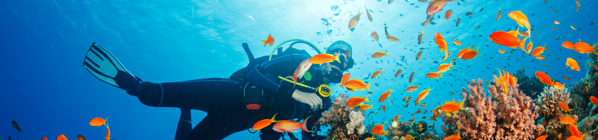
| The Transect Line – November 2010 | |
| Brunei to Monitor New MPA Network with Reef Check | |
 By Reef Check’s Executive Director Dr. Gregor Hodgson By Reef Check’s Executive Director Dr. Gregor Hodgson
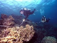
Brunei Darussalam is a tiny nation nestled between the Malaysian states of Sarawak and Saba on the historic island of Borneo. The country has an area of only 5,265 sq km and a population of about 400,000. High diversity coral reefs are found throughout the South China Sea within Brunei waters. During the past 20 years, Brunei has focused on economic development, particularly oil and natural gas, and has the highest per capita GDP of any country in Asia (US$50,000). In 2009, after Brunei was invited to join the Coral Triangle Project, the Brunei Fisheries Department sought to document its coral reef resources and to protect them. In 2009, two books were published by the Ministry of Industry and Primary Resources — ‘Coral Reefs of Brunei Darussalam’ and ‘Reef Fishes of Brunei Darussalam’ that document more than 400 coral species and more than 600 reef fishes found in Brunei waters by teams led by Gerald Allen and Lyndon Devantier. This year, the Fisheries Department under the leadership of Director (Ms.) Hajah Hasnah binti Ibrahim, requested Reef Check to train a team of EcoDivers so that they could establish a regular monitoring program leading up to creating a network of marine protected areas. During November 2010, I invited Reef Check Malaysia Director Julian Hyde to help me to train up a diverse and enthusiastic group of 15 fisheries staff, dive shop instructors, commercial and recreational divers to become EcoDivers. Coming from different backgrounds, the participants were able to add very different perspectives on marine monitoring and management. They even got a “free” oxygen seminar from the commercial diver during a coffee break.
Julian has pioneered a number of kid’s education initiatives in the islands of Malaysia. A former dive shop owner and scuba instructor, he was the perfect partner for this training – focusing on buoyancy issues in the water and presenting information on the kids programs in neighboring Malaysia. The final day of the training was spent on designing a draft monitoring program for the nation’s reefs. The group was able to design a program that would allow them to monitor all of their major reefs with replicate surveys using only two survey days per month at about 70 reef sites. The end of the training was marked by a ceremony hosted by the Ministry and plenty of great food. In 2011, Brunei will be opening its new coral reef education center and launching its first round of Reef Check surveys. If your MPA or region would like to set up a monitoring program, Reef Check offers training that includes a Climate Change Monitoring Tool Kit. Contact ecodiver@reefcheck.org |
|
| New Caribbean Study Uses Reef Check Data | |
 The online scientific journal PLos ONE, recently published a study entitled, “Caribbean Corals in Crisis: Record Thermal Stress, Bleaching, and Mortality in 2005.” Reef Check data contributed to the study, which showed that coral reefs suffered record losses in the Caribbean in 2005 as a consequence of high ocean temperatures. The online scientific journal PLos ONE, recently published a study entitled, “Caribbean Corals in Crisis: Record Thermal Stress, Bleaching, and Mortality in 2005.” Reef Check data contributed to the study, which showed that coral reefs suffered record losses in the Caribbean in 2005 as a consequence of high ocean temperatures.
Abstract: Satellite-based tools provided warnings for coral reef managers and scientists, guiding both the timing and location of researchers’ field observations as anomalously warm conditions developed and spread across the greater Caribbean region from June to October 2005. Field surveys of bleaching and mortality exceeded prior efforts in detail and extent, and provided a new standard for documenting the effects of bleaching and for testing nowcast and forecast products. Collaborators from 22 countries undertook the most comprehensive documentation of basin-scale bleaching to date and found that over 80% of corals bleached and over 40% died at many sites. The most severe bleaching coincided with waters nearest a western Atlantic warm pool that was centered off the northern end of the Lesser Antilles. Thermal stress during the 2005 event exceeded any observed from the Caribbean in the prior 20 years, and regionally-averaged temperatures were the warmest in over 150 years. Comparison of satellite data against field surveys demonstrated a significant predictive relationship between accumulated heat stress (measured using NOAA Coral Reef Watch’s Degree Heating Weeks) and bleaching intensity. This severe, widespread bleaching and mortality will undoubtedly have long-term consequences for reef ecosystems and suggests a troubled future for tropical marine ecosystems under a warming climate. |
|
| New Ways to Support Reef Check | |
 Planet Green Recycling Planet Green RecyclingPlanet Green Recycling remanufactures inkjet cartridges and old cell phones. Reef Check will receive funds for every empty inkjet cartridge or old cell phone that we send in for recycling. In addition to the money we receive from recycling, Reef Check will also receive a 15% donation for every cartridge purchased on our Planet Green site (www.planetgreenrecycle.com/reefcheck). Items can either be dropped off at our office or mailed to us.
|
|
| Reef Check California Update | |
| By Reef Check California Director Dr. Jan Freiwald
On the Channel Islands we had more than perfect conditions and were able to survey six sites at Anacapa and Santa Cruz Islands in three days with an awesome team of volunteers and staff. We would begin each day with a large breakfast on the boat and then complete three or four dives to survey our sites. In the evenings we watched amazing sunsets over the islands and enjoyed dinners together. Diving these sites, especially along Anacapa, where a small marine protected area has been in place for over thirty years, always reminds us of the abundance and size that California’s kelp forest fish and invertebrate species can reach when protected from fishing. As the process of implementation of MPAs progresses in southern California, three workshops were held by the MPA Monitoring Enterprise in cooperation with the Department of Fish and Game to provide the opportunity for public participation in the development of methods for ecological and socio-economic monitoring of MPAs in southern California. The workshops were well attended and participants included representatives from commercial and recreational fishing, California tribes and tribal communities, conservation, local, state, and federal agencies and all kinds of ocean users. Our southern California Reef Check staff and I attended these meetings in Santa Barbara, Los Angeles and Carlsbad to provide input on the monitoring plans that are being developed to evaluate the long-term effects of MPAs in this region. The final decision about the implementation of MPAs in southern California will be made by the Fish and Game Commission at a meeting in Santa Barbara on the 15th and 16th of December. Stay tuned for these exciting developments in southern California or go to the public Fish and Game Commission meeting to participate in the process. |
|
| North-Central California Coast Project Completes 1st Year | |
| By Reef Check California’s North-Central Coast MLPA Baseline Coordinator Narineh Nazarian
Mid-August marked the start of the North Central Coast project. We knew this was going to be difficult because of the remote location of this stretch of coast. A converted dairy barn at Stillwater Cove Ranch would become our home base for the next few months. We would keep everything we needed to complete the project, from boats to tanks, compressor, and survey gear, at this wonderful home away from home. Every field day started early with the group loading up all the gear needed for the day into the truck. At this point we were normally greeted by Jerry (the owner of the ranch) with Bessie his dairy cow offering us fresh milk for coffee. Once the crew and truck were ready to go we would head down to the ocean at Stillwater Cove where we would load up the R/V Paragon and set out for the day’s sites. When we reached our site, a team of divers would start fish surveys and the benthic team followed 10-15 minutes behind. Unlike Reef Check’s core transects which include fish, PISCO conducts the fish surveys separate from benthic surveys. A fish team of two would complete 12 fish transects; 3 transects at four depth zones: deep, mid-deep, mid-shallow, and shallow. A benthic team of three would then complete 6 transects each consisting of an algae swath, invert swath, a UPC, and abalone/urchin sizing with 2 transects at three depth zones: deep, mid, and shallow. The abalone and urchin sizing was done by Reef Check to add information on the size structure of these populations at each site inside and outside of the MPAs. This information is important in order to document the population structure at the implementation of these MPAs so that in the years to come marine resource managers can evaluate the effects of these MPAs on abalone and urchin populations against these initial data. Over the two and half months we surveyed 32 sites. Overall, 202 benthic and abalone/urchin transects and 324 fish transects were completed. As we packed and loaded our gear to clear out of the Dairy Barn, I felt very fortunate to be a part of such an exciting endeavor and to have been able to explore such an amazing stretch of coastline to help establish the baseline data against which the effects of MPAs will be measured in the future. I am already looking forward to doing it all over again next year. |
|
| Technical Question of the Month | |
 Each month, Reef Check will answer a technical question regarding the monitoring protocol of our coral reef or rocky reef programs. If you have a question you would like answered, please email rcinfo@reefcheck.org. Reef Check Tropical — Why use a 5 m gap in the tropical transect surveys? For convenience, we recommend using a single 100 m transect line to carry out Reef Check (RC) tropical surveys. It is simpler to roll out one 100 m line than to use multiple 10m or 20 m lines. In fact, the actual design of RC surveys is based on four 20 m long “segments” of the full transect line. So we sample 20 m, and then leave a 5 m gap, followed by a second 20 m that is also sampled and so on until we have completed all four “segments” for a total of 80 m along the 100 m line. We leave a 5 m gap in between each 20 m segment because we would like each segment to be independent or unaffected by the others. How does this help the data analysis? A common question one might ask about a data set from a Marine Protected Area (MPA) is whether there are more grouper inside the MPA than outside. To test this hypothesis, we need to use statistics to compare the mean number of grouper inside and outside. When we carry out statistical analyses using what are known as parametric statistics (e.g. a t-test) there are certain requirements that must be met. One is that the samples (our segments) are independent of each other and that each sample is random. For example, if we did not use a 5 m gap, then one large coral might grow across the boundary between the first and second 20 m segments. In that case, the data would not be independent because the same coral was found in both segments – the coral in the first segment “affects” the presence of the same coral in the second segment. So we use the 5 m gap to increase the independence of our samples. It is not a perfect solution but it helps prevent what is known as “pseudoreplication.” While most scientific monitoring methods used in ecology “violate” some of the prerequisites of parametric statistics we can still analyze tropical data using parametric tests. In addition, there are many non-parametric tests available to analyze RC data. Why do ecologists not use a strictly random sampling design? A true random sampling design is very costly and may have its own biases when for example, by chance, many randomly chosen sample points cluster in one area. Thus we have chosen the most efficient method for Reef Check that also allows us to use parametric statistics. Of course, those who prefer to use shorter reels – 10 m or 20 m long transects may lay these on separate sections of reef. In some areas with patch reefs or spur and groove formations – this will be the logical choice. |
|
| Successful EcoExpedition Completed in Oman | |
| By Reef Check United Arab Emirates Coordinator Rita Bento
The Musandam Peninsula, also known as Ru’us al-Jibal, is an exclave of Oman separated from Oman by the United Arab Emirates. It is situated on the Arabian Peninsula in the Strait of Hormuz, the narrow passage that links the Arabian Gulf and the Gulf of Oman. Even though the Arabian Gulf’s corals are unique and seem to endure extremely harsh conditions when compared to corals in other parts of the world, scientists are increasingly concerned that any additional stress, imposed by global climate change or regional coastal development, may accelerate coral die-off. Reefs in the Arabian Gulf have been devastated by major coral bleaching events (in 1990, 1996, 1998 and 2002), cyclone Gonu in 2007, and recently by extensive coastal developments along the Arabian Peninsula. The impact extends beyond the shoreline, since turbidity and suspended sediments are dispersed from the dredge or reclamation sites. In addition, currents are diverted by coastal engineering, altering the movement of sediments and causing them to accumulate. The coral reef losses from climate-related devastation and massive coastal development on the Arabian Peninsula have made this region amongst the most damaged in the world with the lowest predictions for recovery. According to recent estimates, 30% of the coral reefs are at a threatened-critical stage and up to 65% of the coral reefs may have been lost already due to natural causes (fluctuation of temperatures, diseases), and anthropogenic stresses (oil pollution, unmanaged coastal development, unregulated commercial and recreational fishing and diving). Nevertheless, the 34% of hard coral coverage measured by Reef Check surveys in 2009 is encouraging. Many thanks to our partners Sultan Qaboos University, the Oman Ministry for Environment and Climate Affairs, the Oman Tourism Board, as well as the United Nations Environment Programme, the World Conservation Monitoring Centre and the International Coral Reef Action Network (ICRAN). Further support comes from a Six Senses (Zighy Bay) environmental grant, as well as from HSBC, Land Rover and Swarovski Optik. Join us in Oman in 2011! Two trips have been scheduled for October. Click here for details. |
|
| First EcoDivers Trained in Saudi Arabia | |
 Dr. Mohammed Kotb of PERSGA (the Regional Organization for the Conservation of the Environment of the Red Sea and Gulf of Aden) recently certified 11 divers representing the Presidency of the Meteorology and Environment Protection, the official authority in Saudi Arabia concerned with environmental protection. Training began three months ago as part of PERSGA’s rigorous training program that includes marine background information, advanced diving skills, underwater photography, and survey techniques. PERSGA is carrying out this training program to increase the skilled governmental capacities in the Red Sea and Gulf of Aden Region. The trained groups will then be able to implement underwater damage/status assessment and monitoring tasks. PERSGA is aiming to offer this program to the national marine environmental specialists in the other five countries of the region (Djibouti, Egypt, Jordan, Somalia, Sudan, and Yemen). Dr. Mohammed Kotb of PERSGA (the Regional Organization for the Conservation of the Environment of the Red Sea and Gulf of Aden) recently certified 11 divers representing the Presidency of the Meteorology and Environment Protection, the official authority in Saudi Arabia concerned with environmental protection. Training began three months ago as part of PERSGA’s rigorous training program that includes marine background information, advanced diving skills, underwater photography, and survey techniques. PERSGA is carrying out this training program to increase the skilled governmental capacities in the Red Sea and Gulf of Aden Region. The trained groups will then be able to implement underwater damage/status assessment and monitoring tasks. PERSGA is aiming to offer this program to the national marine environmental specialists in the other five countries of the region (Djibouti, Egypt, Jordan, Somalia, Sudan, and Yemen).
|
|
 Following the standard one-day classroom session, we spent the next three days practicing surveys and ultimately completing one survey at Pelong Rock, just a short boat ride from the harbor. With annual rainfall in Brunei averaging 3 m (more than nine feet), there is a lot of runoff and sediment. As a result, high turbidity is common. While text books on coral reefs typically list the “requirement” for clear water, the reality is that many corals live happily in turbid water, and Brunei reef corals are no exception, with very large colonies of the massive growth forms of Porites and table corals (Acropora) – several meters in diameter. As usual in highly diverse reef systems, a great deal of time is spent teaching participants what is not a Reef Check indicator as well as what should be included. Like most teams, everyone loves the hand signals for communicating substrate types – thanks to Dr. Al Licuanan of RC Philippines and Kim Obermeyer of RC Thailand for developing them. (Hint to old Reef Checkers – ask for a new training disk).

 This summer Reef Check California had an exciting field season along California’s North Central Coast. As some of you may know, starting in May of this year marine protected areas (MPAs) were established in Sonoma and Mendocino spanning from Salt Point to Point Arena. With the introduction of the new MPAs came the need to collect baseline data for monitoring and RCCA became a partner in a
  For the second year,