 Subscribe to Newsletter
 Donate
 Shop
Shop 0
0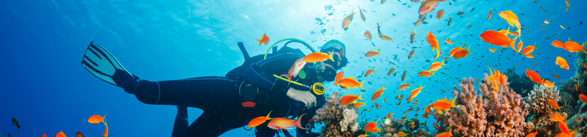
| The Transect Line – March 2011 | |||||
| Haiti’s Reefs Most Overfished in the World | |||||
| By Reef Check’s Executive Director Dr. Gregor Hodgson
We carried out two types of surveys – manta tows for rapid large area surveys and standard Reef Check protocol surveys. Using this mix, we were able to survey about 120 km of coastal reef. The initial surveys covered the coast around La Gonave – a large offshore island, and near St. Marc on the mainland. The high biodiversity reefs feature a full complement of Caribbean fish and invertebrate species, and the reef structure still provides excellent fish habitat. What was astonishing was the high diversity and quality of Haiti’s coral reef structures and the lack of fish. Haiti’s coral reefs must have been truly world class in the 1970s with dramatic drop-offs and huge stands of coral with high vertical relief. At this point, Haiti’s reefs are hanging on — with some large stands of the Elkhorn coral, now on the US Endangered Species List, but we saw almost no food fish of reproductive age. The largest Reef Check indicator fish we observed was about 6 inches (15 cm) long. Every 100 m along the reefs, we observed a large fish trap, fishing net, spear or line fisherman. What is amazing is that almost all fishing in Haiti is still done from paddle or sailboats.
There are three objectives of the project: 1) survey the reefs of Haiti, 2) train local teams of Reef Check EcoDivers who can regularly survey Haiti’s reefs, 3) based on the survey data, recommend to the government the establishment of a network of marine protected areas. Haiti is the only country in the Caribbean without a marine protected area. Healthy coral reefs can provide up to 35 metric tons of fish per square kilometer, whereas overfished reefs such as those in Haiti provide a tiny fraction of this amount. By setting aside areas of coral reef where reef fish can grow and breed without disturbance, more fish and larger fish will produce millions of new young fish every year which would increase the available fish supply for Haitians. Even before the earthquake, Haitians were short of food with 58% of the population under-nourished and some children reportedly being fed mud cakes seasoned with salt. The 10 million people of Haiti make up 25% of the total population of the Caribbean and are growing rapidly at 2.5% annually. Haiti ranked 148th of 179 countries on the United Nations Development Programme Human Development Index prior to the earthquake; 76 percent of Haitians live on less than $2 USD per day. Haiti imports 48 percent of its food. Unfortunately, despite millions of dollars spent on environmental work in Haiti by aid agencies, almost all of it has focused on terrestrial issues, neglecting the potential that improved management of coral reefs and associated fisheries could play in improving food supply and nutrition. Haiti is an island country surrounded by coral reefs. Most experts have assumed that Haiti’s reefs were destroyed by sedimentation long ago. Sedimentation does affect some large areas of reef. The project has been generously supported by Philippe Bayard of Haiti Audubon Society and Einar Madsen. We are very grateful for the wonderful hospitality, advice, accommodation and boat time. |
|||||
| Reef Check Data in Reefs at Risk Revisited Report | |||||
 By Reef Check Public Relations Intern Remy FranklinWorld Resources Institute (WRI), a global environmental think tank, released a report this month called Reefs at Risk Revisited. The report compiled data from numerous government agencies, international organizations, research institutions, universities, nongovernmental organizations, and initiatives. Reef Check was an important partner in the report’s analysis. By Reef Check Public Relations Intern Remy FranklinWorld Resources Institute (WRI), a global environmental think tank, released a report this month called Reefs at Risk Revisited. The report compiled data from numerous government agencies, international organizations, research institutions, universities, nongovernmental organizations, and initiatives. Reef Check was an important partner in the report’s analysis.
The new report finds that approximately 75% of the world’s coral reefs are currently threatened by local and global pressures. Local pressures pose the most immediate threat—especially from overfishing and destructive fishing, which is particularly widespread in Southeast Asia. Other key findings of Reefs at Risk Revisited included the following:
Reefs at Risk Revisited builds on WRI’s 1998 report, Reefs at Risk, which served as “a call to action for policymakers, scientists, nongovernmental organizations, and industry to confront one of the most pressing, though poorly understood, environmental issues”. The initial report played a critical role in raising awareness and promoting action to protect marine areas and lessen risks. Reef Check has helped to develop a new, detailed assessment of the status of and threats to the world’s coral reefs by assisting with the Reefs at Risk Revisited project. According to WRI’s Executive Summary, the project evaluates threats to coral reefs from a wide range of human activities, and includes an assessment of climate-related threats to reefs. It also contains a global assessment of the vulnerability of nations and territories to coral reef degradation. The results of this project will act as a catalyst for changes in policy and practice that could preserve coral reefs and the benefits they can provide for future generations. Click here to download the full report. |
|||||
| Reef Check Helps Design Tracking of the Convention on Biological Diversity | |||||
| By Reef Check’s Executive Director Dr. Gregor Hodgson
So far 163 countries have ratified the treaty but it has been difficult to track progress. In 2010, a series of five Strategic Goals and twenty Targets were drawn up to try to help determine how well countries are achieving biodiversity conservation. Named the “Aichi Targets” (for the town where the targets were agreed), the Strategic Goals are:
A number of the Targets involve issues that overlap with the mission and goals of Reef Check. Three in particular are of interest. Under Goal B, Target 6 pertains to sustainable fisheries management — a focus of Reef Check:
Under Goal B, Target 10 specifically singles out coral reefs: “By 2015, the multiple anthropogenic pressures on coral reefs, and other vulnerable ecosystems impacted by climate change or ocean acidification are minimized, so as to maintain their integrity and functioning.” Under Goal C, Target 11 is focused on protected area networks – another priority for Reef Check: “By 2020, at least 17 per cent of terrestrial and inland water, and 10 per cent of coastal and marine areas, especially areas of particular importance for biodiversity and ecosystem services, are conserved through effectively and equitably managed, ecologically representative and well connected systems of protected areas and other effective area-based conservation measures, and integrated into the wider landscapes and seascapes.” In February, Reef Check was requested by Dr. Clive Wilkinson of GCRMN to attend a Workshop of 50 ecosystem specialists to design monitoring plans that could allow countries to track compliance with CBD Targets. This was an opportunity to suggest a number of monitoring programs including our own Reef Check tropical and temperate protocols to help monitor changes in reef ecosystems. What was surprising is how few ecosystems have any historical data on a global or even regional scale. Because Reef Check began in 1997, we have one of the only long term global databases available for any ecosystem, hence changes can be tracked and compared with the previous condition of reefs. Hopefully, by including Reef Check in the CBD monitoring program, this will also encourage more national governments to include Reef Check in their coral reef monitoring and management plans. For more information on CBD and Targets, please see: www.cbd.int/sp/targets/ |
|||||
| Reef Check California Update | |||||
By Reef Check California Director Dr. Jan Freiwald It is almost the field season again at Reef Check California! Over the winter we compiled all our data and this month we will release our newest database containing 5 years of monitoring data covering the entire state. We have come a long way since RCCA’s first field season in 2006. Over the five years we have conducted over 300 surveys from 78 sites ranging from San Diego to Humboldt County and have trained 700+ citizen scientists. With the new data release the results of all this work, which could not have been possible without the enormous efforts by our volunteers, will be publicly available and ready to be used by stakeholders, marine managers and policy makers and the general public to inform the management of California’s marine resources. Go to our Nearshore Ecosystem Database (NED) at http://ned.reefcheck.org to sign up and download it, or to take a look at our graphical display of 5 years of data. It is almost the field season again at Reef Check California! Over the winter we compiled all our data and this month we will release our newest database containing 5 years of monitoring data covering the entire state. We have come a long way since RCCA’s first field season in 2006. Over the five years we have conducted over 300 surveys from 78 sites ranging from San Diego to Humboldt County and have trained 700+ citizen scientists. With the new data release the results of all this work, which could not have been possible without the enormous efforts by our volunteers, will be publicly available and ready to be used by stakeholders, marine managers and policy makers and the general public to inform the management of California’s marine resources. Go to our Nearshore Ecosystem Database (NED) at http://ned.reefcheck.org to sign up and download it, or to take a look at our graphical display of 5 years of data.
Last year we added four sites to our monitoring network. We were also able to survey several sites in northern California that we had not gotten to in several years, for example, our site at Sea Lion Rock north of Point Arena. In addition to these sites we surveyed 34 new sites in collaboration with the PISCO research group from UC Santa Cruz for abalone and sea urchin densities and size frequencies, as part of our work on the baseline monitoring project for the new Marine Protected Areas along the North Central Coast region of the MLPA initiative. We hope that many of you will take a look at the data, use it and get inspired to collect more data this upcoming year! Personally, I have been with Reef Check for one year now and I am still always amazed by the commitment and enthusiasm of all of our volunteers. I am looking forward to another successful training and survey season this year, and can’t wait to see all of the familiar faces out on the water again at the recertifications and surveys or, if you are new to Reef Check, at one of our trainings. Our training and recertification schedules are posted at https://reefdpd.wpengine.com/rcca/training_schedule.php and surveys are posted on our discussion forum. There are several new training locations this year. We will have trainings in Fort Bragg, Mendocino County and one in San Luis Obispo – both regions of the state where we would like to engage more divers and continue to grow our program. Please take a look at the schedule and sign up if you are interested in surveying this year. |
|||||
| Massive Fish Die-Off in Redondo’s King Harbor, Southern California | |||||
 By Reef Check California’s SoCal Volunteer Coordinator Laurel Fink By Reef Check California’s SoCal Volunteer Coordinator Laurel FinkPhotos courtesy of RCCA volunteer Dana MurrayMillions of sardines were found belly-up in the north side of King Harbor the morning of March 8, 2011. This massive amount of dead fish (>140 tons) has caused a huge clean-up effort and quite a smelly mess for the slip owners and residents around the harbor. Initially believed to be a cause of solely oxygen deprivation in the narrow enclosed areas of the harbor, results from samples of fish tissues showed a high amount of domoic acid present in the sardine’s stomachs. This neurotoxin, which is released during phytoplankton blooms, reached high levels in Santa Monica Bay about 12 miles offshore of the harbor in the days prior to the fish die-off. Authorities from the University of Southern California and California Department of Fish and Game think now that the domoic acid caused the sardines to become disoriented and swim into the harbor, and caused increased physiological stress brought on by the low oxygen levels in the water. With millions of sardines enclosed in the small harbor space, the remaining oxygen in the water was quickly used up by the huge demand of so many fish. Additionally, the storms in the southern California area prior to this event may have caused waves to further push the schooling fish into the harbor. King Harbor experienced a similar fish die-off about 5 years ago, also caused by a red tide bloom event in the bay.
On a positive endnote, the removed tonnage of sardines are being transported to Victorville (American Organic) to be reused and composted into organic fertilizer. |
|||||
| Technical Question of the Month | |||||
 By Reef Check’s Executive Director Dr. Gregor HodgsonEach month, Reef Check will answer a technical question regarding the monitoring protocol of our coral reef or rocky reef programs. If you have a question you would like answered, please email rcinfo@reefcheck.org. By Reef Check’s Executive Director Dr. Gregor HodgsonEach month, Reef Check will answer a technical question regarding the monitoring protocol of our coral reef or rocky reef programs. If you have a question you would like answered, please email rcinfo@reefcheck.org.
Reef Check Tropical – What is the goal and practical application of transect deployment in a Reef Check survey? The Reef Check coral reef monitoring protocol is based on the use of a transect line to measure distance and area and a plumbline to determine a point sample location along the line. A fundamental consideration when using a transect line to sample reefs is how the transect line is deployed. On one extreme, the transect could be pulled tight above the reef while at the other extreme the transect could be deployed with more slack to follow the vertical relief of the reef. In fact, in 1972, James W. Porter1 published a paper on a survey protocol using a chain link transect line that closely followed the surface of the reef. What is the goal and practical application of transect deployment in a Reef Check survey? The fundamental question is: are we trying to sample a horizontal representation of a 3-D structure – the surface of the reef? The answer is yes because our plumbline method and instructions are based on the plumbline aligned perpendicular to the transect. So how does the position of the transect line with respect to the angle of the reef at a given point affect our estimates of cover? My conclusion is, “not much.” In some respects, this is actually a scale question along the lines of, “how long is the coast of Sweden?” If you followed every vertical cm of relief, you might be able to “use up” the 100 m tape in 20 m of horizontal distance. There are several practical issues involved as well. Given that we are using fiberglass survey tapes these days as transect lines, the transect line can also float if it is not stretched taut. Slack lines can swing widely in current and waves making plumbline use difficult. For RC, the primary objective is that we want to let the transect line stay within each depth zone and follow the depth contour. Then we want the line to follow the vertical relief sufficiently so that we are not creating 1+ m vertical gaps between the line and the reef. In practice, in a wave washed environment, the line is typically given a quick wrap around a rock every 10 to 20 m to prevent swinging so the result is that some of the transect is in direct contact with the reef while in other areas it may end up getting pulled relatively taut – hanging above the reef. Since we are point sampling – a slack line deployment could create a bias by bringing sample points slightly closer together by following the relief more closely, and to shorten the horizontal distance covered by the entire transect — probably not a serious bias in most situations. Even on a perfectly calm day, most transects will probably end up including a mixture of some relatively taut and some more slack sections such that we reduce sections of swinging transect or sections hanging more than 1 m above the substrate. In terms of what to aim for and how to teach, I would suggest pulling the line a bit tighter on flat sections and letting it drape when going over large coral heads/rocks that create 1+ plus vertical gaps. Remember that the fiberglass tapes will break if pulled too tight. Thank you to Dr. Jonathan Shrives, a long-time Reef Check Trainer now based in Jersey, for requesting clarification on this issue. 1Patterns of Species Diversity in Caribbean Reef Corals |
|||||
| Reef Check Malaysia Releases Annual Reports | |||||
 Reef Check Malaysia (RCM) recently published two reports on its coral reef activities. The Annual Survey Report is a technical report, based on Reef Check surveys, on the state of coral reefs in Malaysia. It includes highlights on the findings for 2010 and comparisons of data collected over the past four years. Click here to download the report. Reef Check Malaysia (RCM) recently published two reports on its coral reef activities. The Annual Survey Report is a technical report, based on Reef Check surveys, on the state of coral reefs in Malaysia. It includes highlights on the findings for 2010 and comparisons of data collected over the past four years. Click here to download the report.
The Annual Report describes the activities that RCM conducted in 2010, and some recommendations to relevant authorities on how to get involved in the conservation and management of Malaysia’s marine resources. Click here to download the report. |
|||||
| Reef Check Contributes to “Cabo & Coral Reef Explorers” Book | |||||
 Dive in! This adventurous tale is a sequel to the popular “Cabo and Coral Go Surfing!” and “Cabo and Coral’s Secret Surf Spot!” books by Dr. Udo Wahn. These are educational and inspirational books for the ocean-minded child, and Reef Check has contributed information about its Baja program for incorporation into Cabo and Coral’s latest adventure. Dive in! This adventurous tale is a sequel to the popular “Cabo and Coral Go Surfing!” and “Cabo and Coral’s Secret Surf Spot!” books by Dr. Udo Wahn. These are educational and inspirational books for the ocean-minded child, and Reef Check has contributed information about its Baja program for incorporation into Cabo and Coral’s latest adventure.
In “Reef Explorers,” the author reveals his thoughts on sharing and preserving our precious ocean resources. The vibrant captivating art and Dr. Wahn’s insight provides children with tips on how they can be responsible for keeping our ocean reefs protected, and how to live the aloha spirit. Children will learn about sustainable fishing, Marine Protected Areas, and gain an understanding of how ocean reefs play an important role in the overall balance of our planet. Please visit www.caboandcoral.com for more information. |
|||||
| Public Outreach Volunteers Needed – Help Us Tell the Reef Check Story! | |||||
 Do you care about the ocean and enjoy meeting new people? Reef Check needs help from Los Angeles area volunteers at public events. We will specifically need volunteers for the following Earth Day events in April. Volunteers must be energetic individuals who are passionate about ocean conservation, and feel comfortable talking with visitors at the Reef Check booth. Do you care about the ocean and enjoy meeting new people? Reef Check needs help from Los Angeles area volunteers at public events. We will specifically need volunteers for the following Earth Day events in April. Volunteers must be energetic individuals who are passionate about ocean conservation, and feel comfortable talking with visitors at the Reef Check booth.
If you are interested, please contact our Program Manager for Outreach Mary Luna. |
|||||
 In February, we completed our first round of surveys of Haiti’s reefs – the first ever comprehensive survey of coral reefs in the country. The work is part of a 3-year MacArthur Foundation-funded Marine Resource Management Project to build conservation capacity. The team included a Haitian marine biologist, Erika Pierre-Louise and a Creole-speaking graduate student from Harvard, Edward Beucler.


